MarketMaps
Iowa Business Reference
5 Digit ZIP Code Wall Map
2026 Edition
Product Description
Product Description
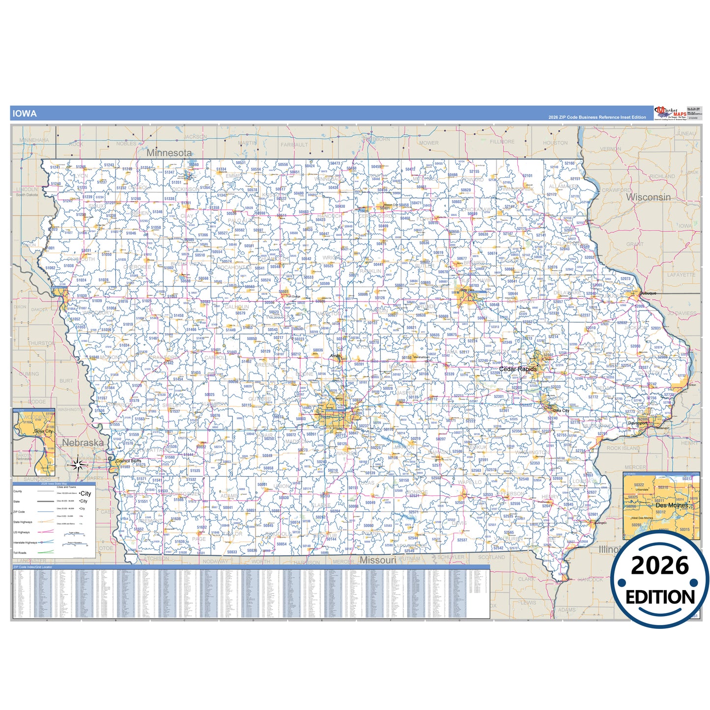
The Hawkeye State, Iowa, in Business Reference Style is a detailed, professional wall map designed for presentations, office displays, and classroom use. Featuring traditional color schemes and clear map details, this Iowa map showcases all major highways with precise highway markings and shaded populated areas for easy reference. Ideal for business planning, route mapping, and geographic visualization, the Business Reference Style Iowa Map provides a clean, visually appealing layout that is perfect for offices, schools, and meeting rooms.
- Interstates, U.S., and State Highways: Includes I-29, I-35, I-74, US-6, US-18, US-20 and more across Iowa.
- Cities and Towns: Ames, Cedar Rapids, Council Bluffs, Davenport, Des Moines, and surrounding towns.
- County Names and Boundaries: All 98 counties including Black Hawk County, Clinton County, Dubuque County, Johnson County .
- Parks and Green Spaces: Big Creek State Park, Brushy Creek St Recreation Area, Desoto National Wildlife Refuge, Hawkeye Wildlife Management Area and more.
- Water Features: Cedar River, Clear Lake, Iowa River, Mississippi River
Key Features: