MarketMaps
Indiana Business Reference
5 Digit ZIP Code Wall Map
2026 Edition
Product Description
Product Description
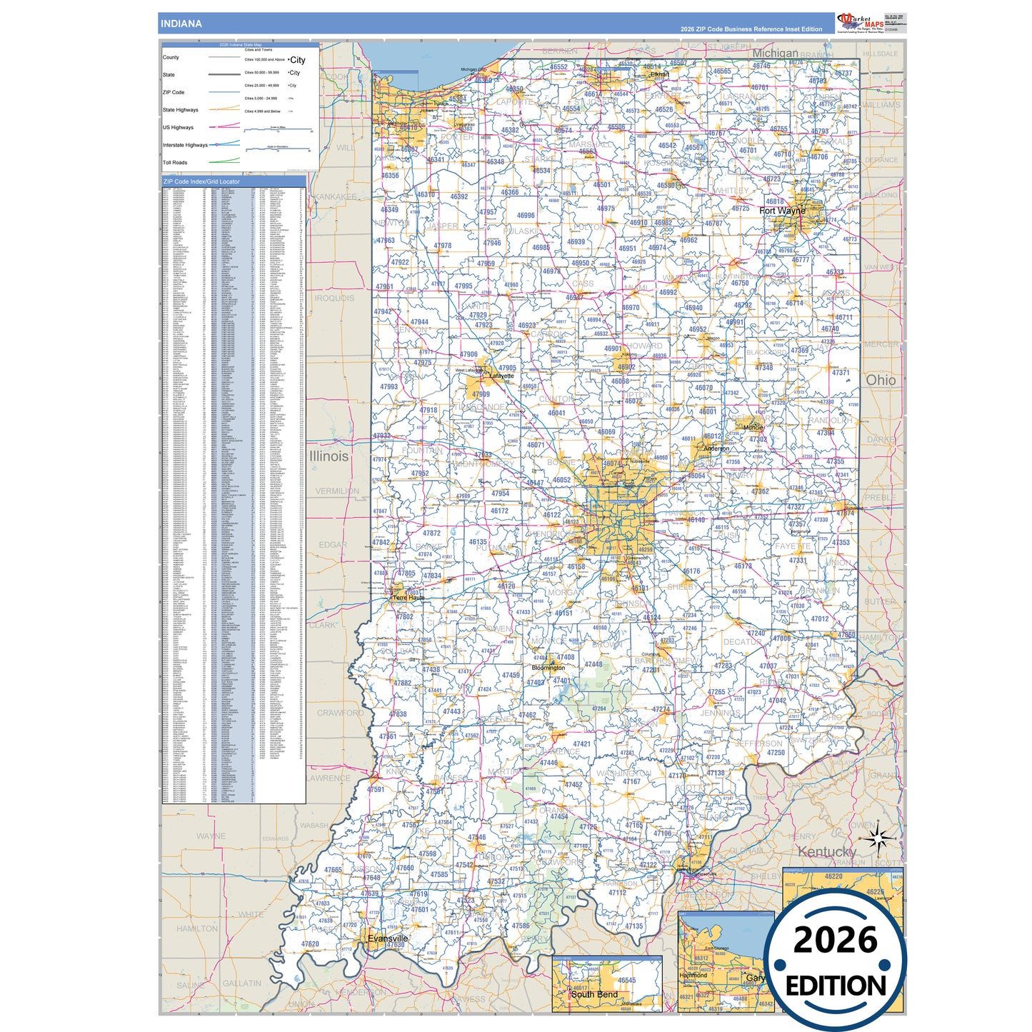
The Hoosier State, Indiana, in Business Reference Style is a detailed, professional wall map designed for presentations, office displays, and classroom use. Featuring traditional color schemes and clear map details, this Indiana map showcases all major highways with precise highway markings and shaded populated areas for easy reference. Ideal for business planning, route mapping, and geographic visualization, the Business Reference Style Indiana Map provides a clean, visually appealing layout that is perfect for offices, schools, and meeting rooms.
- Interstates, U.S., and State Highways: Includes I-64, I-65, I-69, US-20, US-24, US-30 and more across Indiana.
- Cities and Towns: Anderson, Bloomington, Evansville, Fort Wayne, Gary, and surrounding towns.
- County Names and Boundaries: All 92 counties including Allen County, Elkhart County, Hamilton County, Lake County .
- Parks and Green Spaces: Brown County State Park, Harmonie State Park, Hoosier National Forest, Indiana Dunes National Lakeshore and more.
- Water Features: Brookville Lake, Lake Wawasee, Mississinewa Reservoir, Monroe Lake
Key Features: